


la ferte-nanteuil

Bernardcom
User

Length
12.7 km

Max alt
173 m

Uphill gradient
190 m
Km-Effort
15.2 km

Min alt
50 m

Downhill gradient
189 m
Boucle
No
Creation date :
2022-09-20 07:33:38.612
Updated on :
2024-01-22 09:33:15.051
4h02
Difficulty : Very easy

FREE GPS app for hiking
 SityTrail
IGN / Geographical institutes
SityTrail Plus
The world is yours!
About
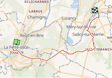
Trail Walking of 12.7 km to be discovered at Ile-de-France, Seine-et-Marne, La Ferté-sous-Jouarre. This trail is proposed by Bernardcom.
Positioning
Country:
France
Region :
Ile-de-France
Department/Province :
Seine-et-Marne
Municipality :
La Ferté-sous-Jouarre
Location:
Unknown
Start:(Dec)
Start:(UTM)
509126 ; 5421960 (31U) N.
Comments